AquaCAT: Flood risk estimates combining the best of techniques from catastrophe modelling and future flood risk assessment tools
A project under the Climate Resilience Programme FUNDED BY THE uk meT oFFICE AND nerc
|
Our proposed approach focuses on fluvial and coastal flooding. In doing so we build upon, and do not repeat, established and detailed modelling chains to provide new metrics that are relevant to understanding the spatial coherence of flood events and how these may change in the future based on analysis of UKCP18 data. This focus is illustrated in the image below.
|
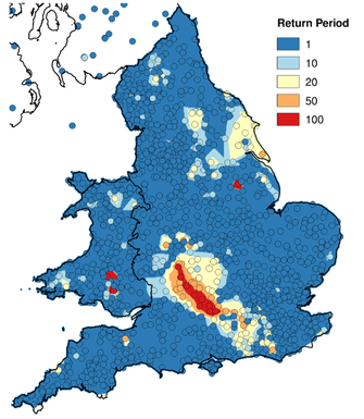
The underlying models will be based on UKCP18, the UKCEH Gird-2-Gird and the Sayers and Partners Future Flood Explorer (FFE). As rt of the dilapidation of the FFE previous projects have proven the ability to look at single events and credibility estimate losses (see below). This capability will be build upon and extended here.

Return periods calculated for surface water flooding in 2007 (Sayers et al, 2015)


